Two Lost Homesteads
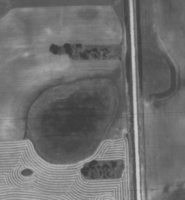
One research question often leads to others as new things emerge and pose new questions. I turned to aerial photography on the North Dakota Aerial Photography Mapservice , an invaluable source of online access to historic map imagery. While I saw no remnants of the lost Broadlawn school, a 1959 aerial survey showed the two clumps of trees below. The trees are to the north and south of what was and may still be a giant wetland that comes and goes depending on rainfall. When I was young, there were a few trees around the wetland, but they were close to its edges. These obviously have farmland separating them from the wetland, suggesting they are on higher ground.
When I turned to the 1892 North Dakota Traill and Steele County Atlas in search of the site of the lost school of Broadlawn Township, I discovered two black squares that represent home sites. The atlas is in the public domain and available a number of places online. I find the easiest one to use is available through Library of Congress here.
In the upper right hand corner of the photo below, in the A.C. Hughes section, the square is the site of what will later be the Holman farm. The two squares on the quarter owned by John Newman seem to correspond with the location of the two clumps of trees in the photograph above. By the time the above photo was taken in 1959, there don't appear to be any buildings. Could the clumps be remnants of home sites, that like so many today, are only saved by the landowners lack of time to reclaim those bits of acres? Who lived there? One was probably Newman, but who was the other? More questions.
 | |||||||||||||||||||
| Two homesteads that appear on the John Newman quarter can be seen marked on the 1892 Traill and Steele County Atlas. Courtesy Library of Congress |


Comments