Searching for the lost Summit Trail in the Missouri River Grasslands

A day that hit 80 in October is not to be wasted. I started at the Summit Campground just south of the Theodore Roosevelt National Park. The trail is missing from a number of online maps and has been repeatedly closed due to washouts. There was signage earlier this summer that said it was closed, but that signage is no longer there. It is mapped on the Mah Daah Hey trail website
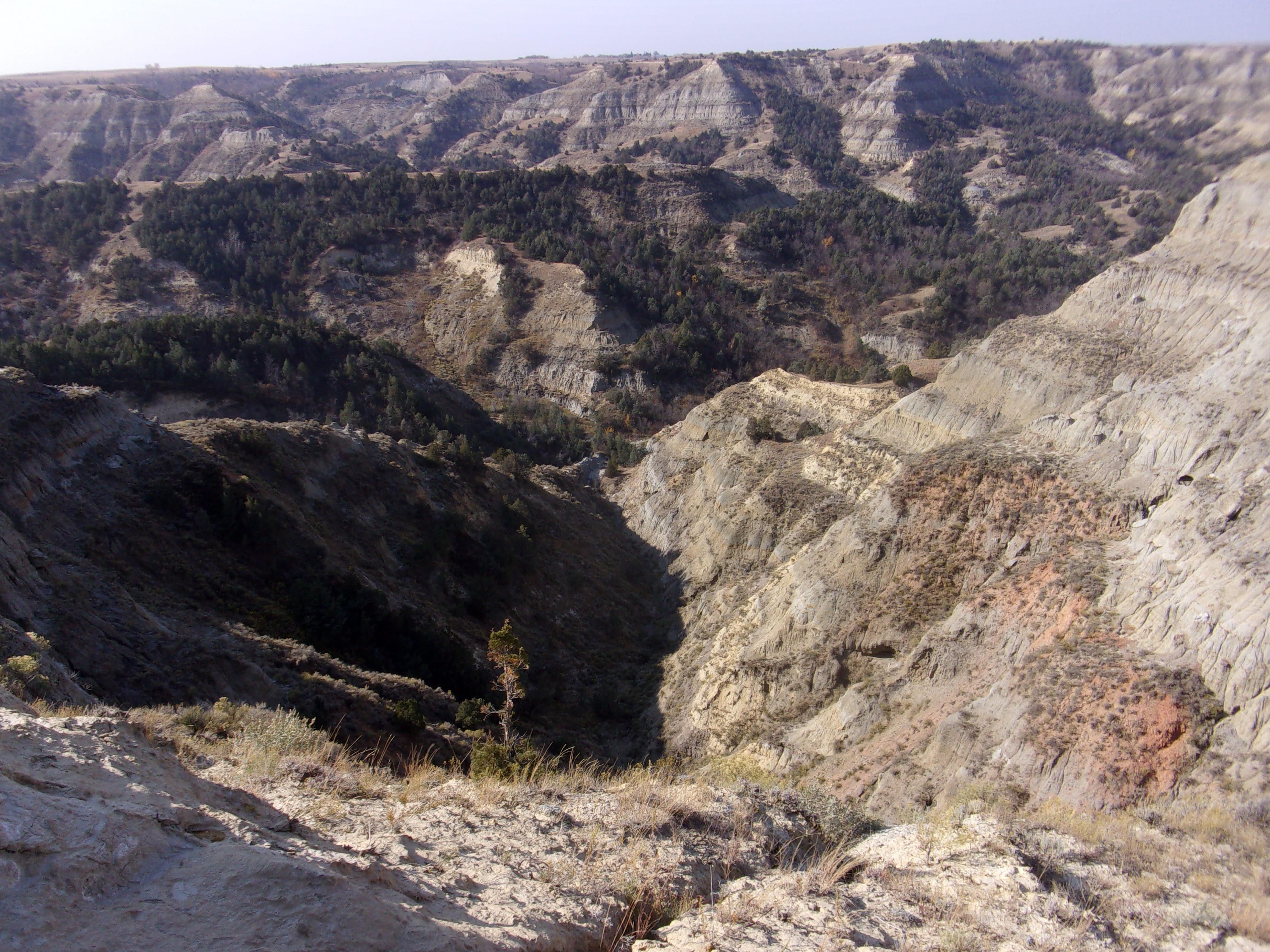


The trail traverses some of the steepest topography in the North Dakota badlands. The trail begins by traversing a few miles of gently rolling terrain flanked by progressively steeper draws plunging on each side. A transition to a radical change in terrain is demarcated by one of the innovative spring loaded gates that mark transitions along the trails in the greater Maah Daah Hey system. Shortly after passing through you reach the Overlook that dead ends at the edge of a steep canyon.
From this dramatic ending, the trail continues on across a narrow bentonite saddle with steep drops on each side. It then winds up and over a hill before moving downward again across another saddle with even steeper grades plunging away. This is as far as I made it. From that saddle, the trail continues along the steep edge of a cliff for several dozen yards. A once flat trail now slants about 20 degrees downhill with nothing to hold onto but the friction of digging in. Around a corner that I couldn't see past, it seems to be eroded even more possibly reaching parity with the mostly 60 slopes that dive hundreds of feet straight down. This section is basically impassable. One wrong step or earth breaking loose would be bad. The wind in the canyon seemed to be gusting to high 20s or even 30 mph making just standing on level ground precarious. There may be a way up and over the hill with some investigation, but I decided to backtrack.
I next decided to hit it from the other side. via the Maah Daah Hey trail starting at the CCC Campground. I've hiked the full and partial 10 mile loop created by the MDH and its intersection with the Long X several times. The weather 400-500 feet lower had less wind, but high 70s is on the edge of too warm hiking weather. I hiked the few miles out to where the disused Summit Trail meets the Maah Daah Hey at the base of one of the cliffs that shoot hundreds of feet almost straight up. I swear I remember a sign for Summit Trail at the junction earlier in the summer.
With the sun dipping behind the cliffs and shadows getting long, I decided to leave the adventure for another day. If I can reach the eroded cliff section without any other obstacles, it should only be about a mile with a few significant ups and downs. The only way to permanently secure that short section of cliffside trail may be some type of complex engineering that involves a steel catwalk and piles driven so deep into the earth that they won't slide.
I


Comments